Test/Review: My MiniMap
I first came across My MiniMap via a random message on Twitter. Intrigued by their product, a couple more messages were sent back and forth and within a few short days, the map I requested arrived for me to put through its paces.
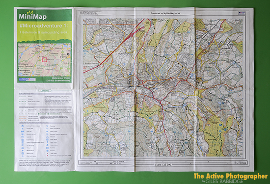
So, just what is My MiniMap? Well, as the name suggests, it is a full-scale map (in the true Ordnance Survey 1:25000 scale fashion) that folds up small enough to be conveniently stored in a jacket pocket etc. Including the clear pouch it comes in, total weight is just 21 grams at a folded size of A6.
The beauty of their service is that, rather than being lumbered with a wide-ranging bulky map, you simply choose a 7km x 6.25km area and this is printed onto a single-sided, A3 waterproof sheet.
For the sake of testing, I selected an area in Hampshire where I was planning my next microadventure, gave the document its title and sub-title, then I was ready to go.
So how did it perform?
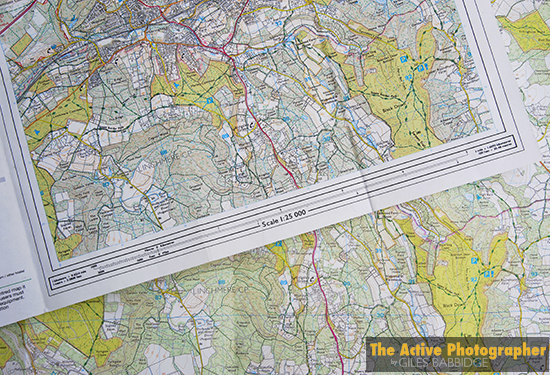
The first thing I did was compare like for like, digging out a brand new Ordnance Survey Explorer map covering the same area (shown as the bottom layer in the picture above). Two distinctions were clear; firstly, the colour – the My MiniMap was darker, showing less vibrant greens, for example. This wasn’t altogether surprising, given the nature of the product/paper stock/waterproofing element. Secondly, the clarity – the OS map appeared more crisp (again, you could put this down to the above factors), although that’s not to say the Map wasn’t clear by any means.
As you might imagine, one of my initial concerns when heading outdoors was to do with the quality of the paper and printing; would it stand up to constant drenching, folding, wiping etc?
I needn’t have worried. Even when being used in non-stop pouring rain, across exposed land and deep within woodland in blustery conditions, the durability of the paper shone through and the clarity of the print was perfectly legible. Even after folding it up, wet, and storing in a rucksack overnight, the Map was just as good the following day.
A nice feature when considered in terms of traditional OS maps is that the legend (key to symbols used) is right there alongside the fully opened map. I’m sure I’m not the only one who has found frustration trying to fold and un-fold a regular map in a breeze, trying to make the legend easily accessible when viewing a particular area to navigate.
Upon return from a trip out, obviously I had to let the Map dry off (which it did quick enough). Aside from slight signs that it had got wet, the thing was essentially almost good as new. There was no evidence of tearing along the folds, no rips along the edges and only minimal loss in detail along the folds (but, realistically, not enough to compromise one’s navigation). Even overall discolouration was minimal, only really visible on the boarder areas.
Let’s be honest, the My MiniMap approach is not going to be for everyone. For example, there are those who just prefer a bigger, traditional OS folding map and, if they are that worried about the wet stuff, they’ll put it in a map case. However, all of that comes at the cost of bulk (and weight, if you’re counting), so the Map’s size advantage is clear.
If you are looking to explore new areas within a small radius, these maps are well worth a look. They’re cheap enough to have produced (£4.99 inc. P&P at the time of writing) and enable you to build a library of personalised maps for your own individual requirements.
Category: Camping, Microadventure, Test/Review

